
Yesterday, I was wondering how much there might be scope, under climate change, to increase crop yields in places that were presently limited by either climate, or the absence of modern agricultural technology. Sharon Astyk suggested that agriculture moving poleward would be limited by poor soil quality.
I don't personally know much about this issue, so I spent some time this morning hunting around to try and develop some better intuition for it. Recall that we were looking at this map of crop yields (which is a rather crude measurement of total crop weight averaged across all crops):

Besides the possibility of better agro-forestry systems in the tropics, obvious questions looking at this map are whether more production can be had from Canada, Argentina, Scandinavia, and northern Russia as they warm up.
The most useful set of maps I found for this purpose where in this presentation (pps). This is based on an analysis of a UN Food and Agriculture Organization (FAO) map of soil types around the globe, and then applies something called the Soil Functional Capacity Classification System, which is designed to assess the suitability of soils for plough-based arable agriculture.
(It's of interest that soil scientists seem to feel that their maps are not good enough, and are working on doing better). But this seems to be the best available at present.)
There isn't a single figure of merit of soil quality provided, but we can look at maps of the various deficiencies and gain some sense of the situation. First up is the areas where the soil is just too darn cold now (soil temperature low, but not actually permafrost):
If you compare to the crop yield map above, you can see that these are mostly areas of low or non-existent yield. Presumably most of this belt will continue to shift northward in coming decades.
Next is a map which shows soils that have various forms of agriculturally significant nutritional deficiencies:

Note the famously poor tropical soils, but also the poor soils in the southeastern US (which may explain why that area is not the epicenter of US agricultural productivity). Also, a lot of eastern Canada has poor soils, as do Scandinavia. However, Argentina, Alberta in Canada and parts of Russia would seem to be ok.
Next is a map of acid soils with aluminum toxicity, which has a lot of overlap with the map of nutritional deficiencies above:

Next up, erodible soils:

Then places with soils that currently tend to be waterlogged:
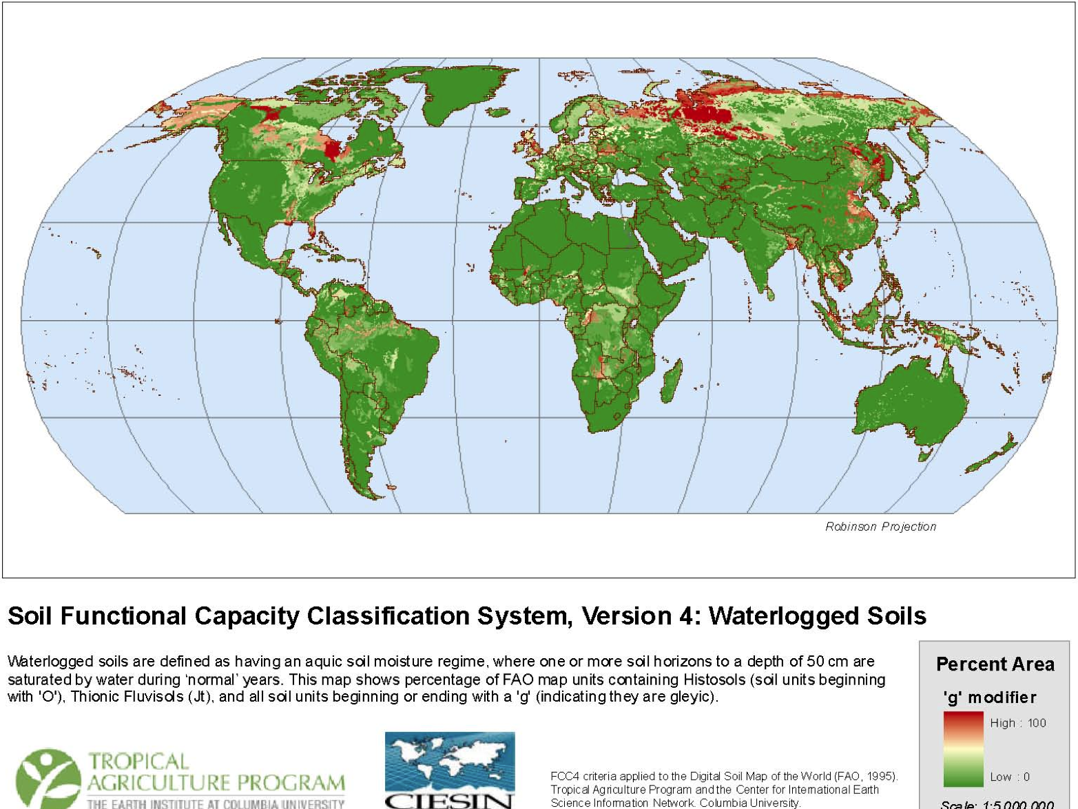
Alberta has some of this going on. However, if you recall the drought severity PCA, Alberta seems to be actually getting drier, so that could be a good trend there. Meanwhile, Argentina seems to be getting wetter, which might allow more agriculture in places that are presently limited by aridity.
There were some other maps of soil problems that are rarer, or relatively easily correctible, but the ones above seem to be the most important.
Now, let me be the first to admit that staring at global soil and climate maps like this is a very crude exercise, and no substitute for detailed knowledge of the areas in question. But on the face of it, it does seem that there might be some non-trivial areas of the planet that have decent soils, but are presently not being exploited due to climatic factors that might improve in the future.

5 comments:
I don't understand that map about K deficiency. Is that just a map of mineral content, without any indication of whether the soil is actually capable of growing something? Cause the entire Saharan desert looks like it's got ok soil, and that's just silly.
This post ties in nicely with Freeman Dyson's recent commentary about our poor understanding of the interaction between topsoil growth and carbon capture, and the potential for climate change mitigation strategies. (A Many-Colored Glass -2007)
He points out that there are large gaps in our understanding of planetary ecology, that could have potentially large influences on climate models.
I'm confused about western Canada. I know they grow a lot of wheat there. But according to the first map, it's not very productive -- and the second map says it's too cold. But ... they do grow wheat there, don't they? I think I've seen it. Maybe they just barely get by?
I also wonder -- in areas where it gets too hot to grow things in the summer, will it be possible to do some planting in the winter instead, if the winters are mild (and damp)? I know there won't be as much sunlight, but what do you think?
My understanding, and it may be Sharon's as well, is that the boreal topsoils are both very thin (commonly less than 20 cm) and very acidic. Now as the sea levels rise in the Gulf of Mexico, and the southern U.S. becomes too hot for agriculture, perhaps the fleeing peasants can move all that delta silt north in wheelbarrows ;)
Glenn
On thing omitted from this discussion is how, as Gordon Orians and Antoni Milewski have shown in ‘Ecology of Australia: The Effect of Nutrient-Poor Soils and Intense Fires’, Australia’s soils – which look more than reasonable on the maps above – are in fact much less fertile even than the “famously poor” tropical soils.
This is consistent with their extreme age – very few new soils have been formed anywhere in Australia since the Carboniferous/Permian glaciations occurring 300,000,000 years ago. In other words, Australian soils are around 30,000 times older than even the oldest soils in most of Europe, North America, North Asia, East Asia, Central America, Andean South America, New Zealand and/or extratropical South America.
Indeed, the factor of 30,000 may be an understatement as to how weathered Australian soils are vis-à-vis soils of the northern and western hemispheres. Most of the period between the Carbo-Permian glaciations and today was globally hot and wet, with tropical cyclones extending even to high latitudes and no permanent ice anywhere in the globe. Under these climatic conditions, even at a high latitude Australia’s soils were subject to extremely intense weathering, so that almost all of them show the effects of formation in a warm to hot and wet climate even under their present arid or seasonally arid meteorological patterns.
What Orians and Milewski point out critically is that Australia soils are uniquely deficient vis-à-vis any other extant continent in not only phosphorus and sulfur – critical macronutrients – but also more interestingly in a large number of volatile chalcophile (also called thiophile) micronutrients like copper, zinc and selenium. This has excluded large herbivores except those of a fecundity too low to tolerate even the most minimal human presence, and has made fire the almost exclusive consumer of the primary productivity. In fact, Australian secondary productivity (natural heterotrophic biomass) is so low as to be two orders of magnitude smaller than any other extant continent, although the limited paleopedological record can easily be interpreted as saying Australian pedological conditions were globally normal before the Oligocene when the Alpine Orogeny and Antarctic Ice Sheet first developed. This is doubly true for marine productivity, where most Australian coasts are warm, oligotrophic, and possessing plankton densities no higher than open ocean gyres.
Thus, the maps above do not cover Australia adequately – one would really need a much darker red covering virtually the whole continent for some degree of accuracy. One can notice Australia’s ancient soils only via the poor yields of crops in suitable climates in southeastern Australia – yields often as little as a quarter those possible in Europe and North America, yet low yields that make much greater profits than possible on the extremely dear land of those youthful continents.
Post a Comment